As of
8/16/00:
1) The WNV epidemic of
1999 only occurred in the tri-state region, no where else in
the U.S. As of 7/28/2000, WNV positives have only been found
in this region with the exception of a single positive bird
found in Boston. The New York Times (8/8/00), while
insisting that the virus had never been found in the U.S.
previous to 1999 (though never looked for previously), felt
confident to write (without stating numbers) that in the year
2000, "the epidemic is settling in... it has spread as
far as Boston", when only 89 WNV positive birds had been
found, all in the original tri-state epidemic area (Boston,
the single exception). Only one human case (non-fatal) had
been found so far in 2000, in Staten Island, when in 1999, 59
human cases were found. The epidemic of 2000 should have been
described with the numbers, thus clearly indicating that the
epidemic has shrunk 95%, staying within the original epidemic
area. The lack of evidence should be admitted for the
arrogant statement of "first arrival" for the West
Nile virus.
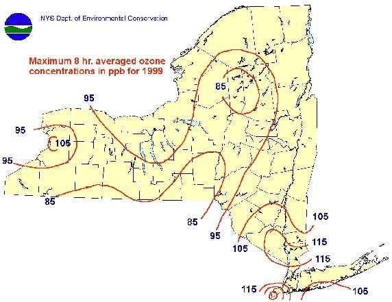
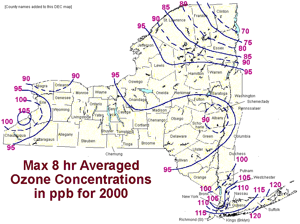
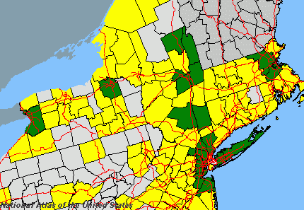
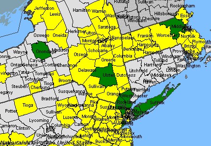
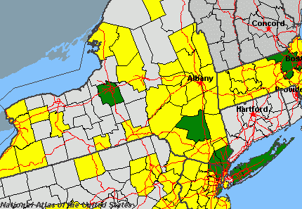
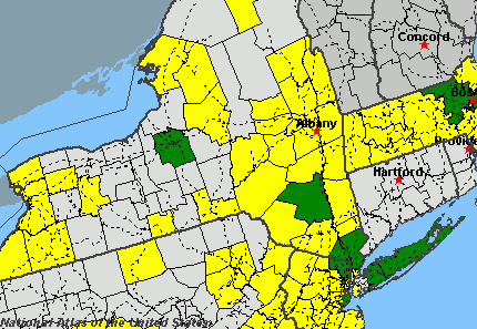
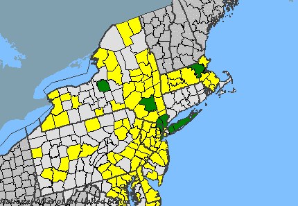
2) Notice in the National
Atlas maps, the "political" West Nile virus of year
2000. It neatly follows state lines, exempting Connecticutt,
as of 7/28/00.
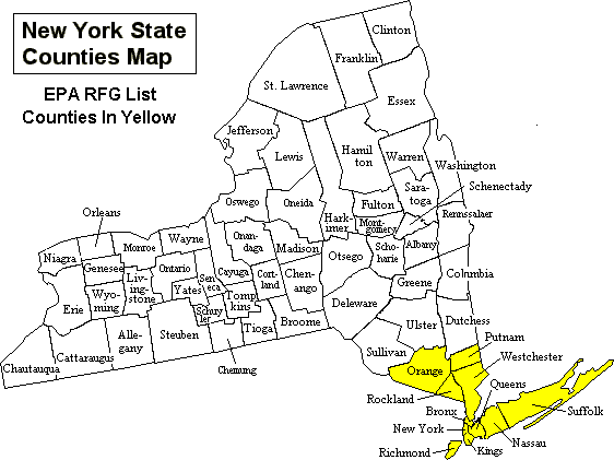
3) Information from
various sources, EPA, DEP, or other, must be put together
piecemeal. Notice how the NRDC portrays Staten Island
(Richmond) as an area free of carcinogenic air pollution,
when Staten Island is has some of the worst cancer incidence
in the country. I recently spoke to a person who personally
knew many people there in their 40s who had died from cancer.
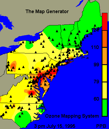
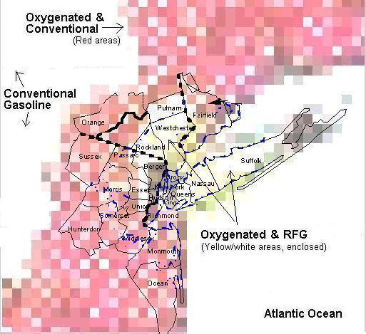
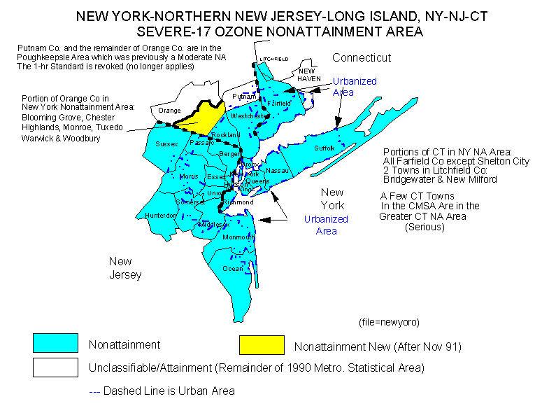
4) The tri-state region
has unique pollution characteristics, unique EPA
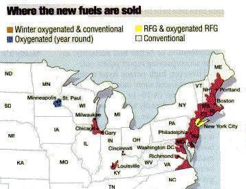
categorization (non-attainment, Severe-17), unique RFG and
RFG oxygenated fuel requirements (MTBE), numerous
expressways, heavy industry, and carcinogenic air-toxin
levels that are 421 times the EPA safe level. According to
the NRDC:
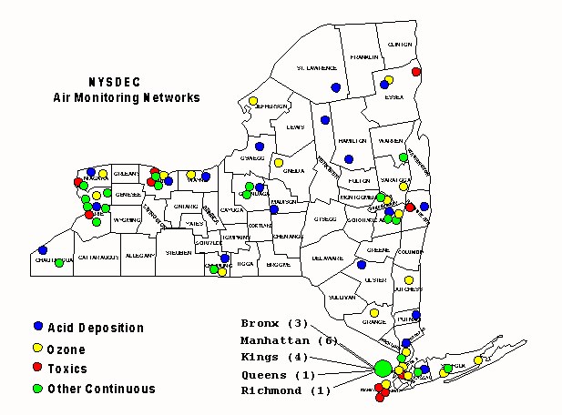
"New York City and
Surrounding Area: "New York County
(Manhattan), one of the five counties within New York
City, has the highest risk in the state with air toxics
levels 421 times EPA’s safe level. In Kings County
(Brooklyn), also within New York City, the levels of air
toxics are 320 times EPA’s safe level of carcinogens
in air."
The most carcinogenic
air-toxic area of Manhattan is an East-West swath across
Central Park, river to river. This has been the area of WNV
positive humans and dead birds in 1999-2000.
"Carcinogenic" does not mean that toxicity is
limited to cancer causation. It is just an available air
toxics study, used herein to indicate potential air
neurotoxic, in lieu.